Location: Bluemount Road, Baltimore County, Maryland
Baltimore metropolitan area
Year: 1997 (record plat)
Developer: Gaylord Brooks Realty Co., Inc., Phoenix, Maryland
Planner/Designer: Land Ethics, Inc., Annapolis, Maryland
(Elizabeth Brabec and Peter Kumble, principals)
Development Size: 169 acres
Number of Units: 22 single family units
Open Space: 142 acres of total area
Wesley Chapel Woods case study document
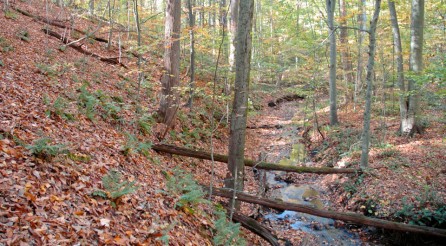
The Wesley Chapel Woods site is located in a sensitive watershed of the Gunpowder River Basin, in Baltimore County, Maryland. The basin of the Gunpowder River is of state level concern for critical habitat, agricultural land protection and as a tributary to the Chesapeake Bay. The sensitivity of the site and region resulted in a zoning designation of Resource Conservation (RC-4). This zoning class limited development to 20 lots per 100 acres, and translated to 33 single-family homes on the 169 acre site.
Prior to development, the site was almost entirely forested with mature hardwood trees in a typical oak-maple-beech climax forest type. The goals of the design were to minimize the impact of home construction on the sensitive resources of the site:
- the water quality of the tributary stream to the Gunpowder River;
- to protect the existing forest cover, a diminishing resource in the region; and
- to maximize habitat protection with wildlife corridors, and forest canopy.
While the County zoning allowed 33 lots and required clustering of those lots, the County’s cluster requirements were modified for this development in recognition that the woodland and water quality of the basin could be more effectively protected with a modified design approach. Although a bit of an oxymoron, a “dispersed cluster” approach to site design was developed, which met the conservation goals of the site, while slightly modifying the development standards. The dispersed cluster approach permitted the design to more effectively protect the woodland by not requiring the clearing associated with three large clusters of homes, their public roads, and three stormwater management facilities.
Applying the dispersed cluster approach, three development areas were designated on the site. Environmental impacts were minimized by the use of 16’ open section private roads as opposed to 21’public roads with curb and gutter. The private roads were field located to avoid sensitive environmental areas and specimen trees. Instead of large amounts of land clearing required under the County’s cluster regulations, lots were field sited, maintaining 100 foot buffers between sites, and minimum 500 foot wildlife corridors between clusters. In addition, private landholdings were limited to 1 to 1.5 acres in size, and the clearing on those lots limited to 7,000 sq. feet. The on site clearing associated with the individual house lots was limited through private covenants registered with the deeds.
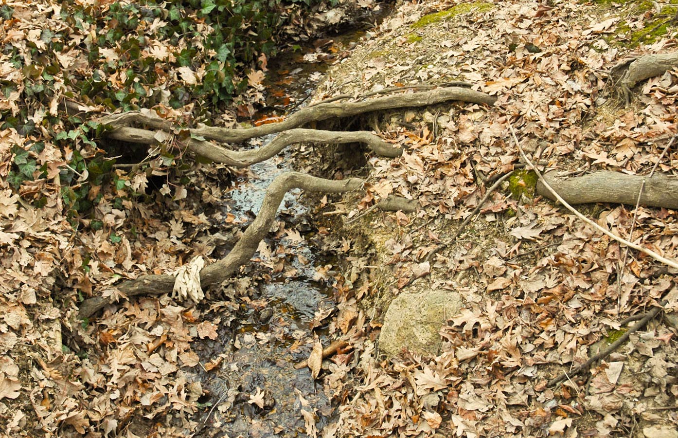
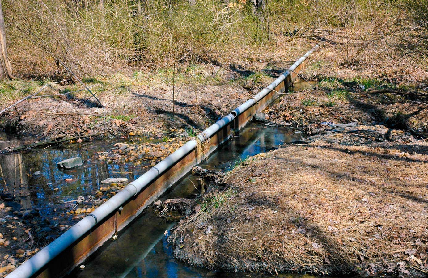
The stormwater runoff was managed entirely on site. Stormwater was directed as sheet flow off the 16’ roads into vegetated verges. The soils are well drained, and the site sloping, therefore the rainfall was absorbed into the forest. During the evaluation 10 years after construction, there was no evidence of erosion or channelization of the stormwater flow. Stormwater from the roofs and driveways of the individual house lots was similarly directed into the surrounding forest, and again, there was no evidence of channelization or erosion.
Although implementing this modified cluster approach resulted in a reduction of density, the financial impact of this was offset by both a saving in development costs as a result of the decreased construction costs of the private roads, and also the lack of stormwater management construction costs. The loss of additional lots was also offset by the increase in value and marketability of the resulting lots surrounded on at least two sides by conservation land.
The development was approved in 1997 and the development sold out in January of 2000.